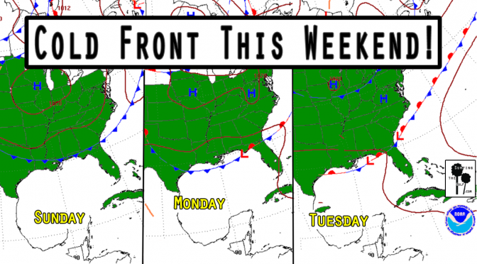
Is it too early to start talking about Fall? It’s not quite Fall, but this cold front doesn’t know that. We’re currently in a pattern of high pressure and light onshore winds with low rain chances. A frontal boundary approaches our area on Sunday. As the front approaches, the pressure gradient will tighten. The tightening pressure gradient will increase the southwest winds. This will increase the humidity and the rain chances. Surf’s up by Sunday afternoon, peaking overnight. Monday the surf continues. The fetch will extend from all the way over by Texas, so the swells should be well formed. The forecast is for 2-4 foot seas at its peak. It’ll be a nice waist high or better swell. The change in the pattern should bring down the temps four or five degrees. Nothing epic, but it could get shortboardable.
Category Archives: Surf Forecasts
Surf Forecast: For Tuesday & Wednesday, June 06 & 07, 2017
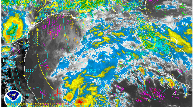
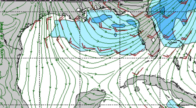
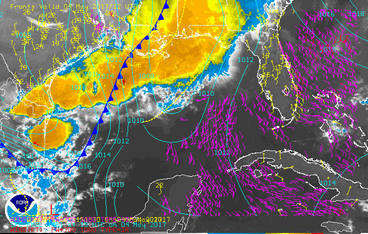
The environment is starting to heat up. This rain and thunderstorm activity appears to be associated with a cold front and tropical low (pictured above). The tropical like weather will continue over the next few days, and bring southwest winds. Tuesday our surf comes up. SWAN has it at 4-5 feet by 3pm. By evening on Tuesday a solid southwest flow will be in place.
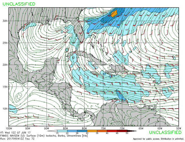
The winds will only be around 15 knots, but there is a lot of fetch. Tuesday evening through Wednesday evening will be in the 4-5 foot seas range. West Florida water temperatures are at 84°, and rain chances at 70%. The mornings and evenings will be the time to surf.
Surf Forecast: Friday 05.26.17 Swell Update
There has been a fun 3 days of surf. The cold front passed overnight last night. After a cold front passes, swell doesn’t usually hold for much more than a day. That’s the situation with this swell. By morning, the winds and surf behind the front will have dissipated. The surf forecast for the next week is for a flat gulf, and in the long range the gulf may fall into a slumber.
Surf Forecast for Wednesday 24th & Thursday 25th
On Wednesday another cold front moves into the gulf and brings up the surf. I can see there being surf all day Wednesday and all day Thursday. It starts out as a southwest swell on Wednesday, gusting to 20 knots or higher. Winds could be in excess of 20 knots on Wednesday during the day, seas reaching 5 feet or more by evening. Thursday morning the swell will peak around 6 feet or more. Expect highs in the mid 80s with a rain chance of about 60% on Wednesday and 40% on Thursday. Don’t forget to check in for the surf’s up surf report to see what’s happening at the beach.
A Wave on Mothers Day ’17
It’s possible that we could see a wave over the next few days. The west/northwest winds will be up as another cold front crosses the gulf. The winds will range from 10 to 15 knots. Saturday and Sunday are the best chances for surf from this front. The chances will be best in the evenings after the sea breeze increases the wind strength, and the sandbars shallow out. The high tides are just after mid-day, and dropping through the afternoon/evening.
Surf’s Up Surf Report: 8am Saturday, May 06, 2017
The Surf’s Up Surf Report:
Or download the video: Surf’s Up Surf Report: Saturday May 06, 2017
The Spring Cold Front Pressure Gradient
It’s nearly here! Are you excited? I’m excited! Who knew weather could be so exciting? I think many of us are eagerly and enthusiastically awaiting the swell! We’re less than 24 hours from really fun surf!