The cold front forecast to move into the area this weekend did indeed, but as a very slowly moving semi-stalled front, what’s being called a surface trough. As this feature made its way into the gulf it completely sheared apart the semi-tropical low that was spinning away in the gulf yesterday. We’re going to see a big change in the weather pattern from the tightening pressure gradient. Wind coming from the middle and east side of the state at similar latitudes will keep high temperatures. Starting tomorrow morning, the big change will come as moderate to strong east wind and lower humidity. The gradient loosens by Friday morning, and we’ll be back in a pattern of slack winds with afternoon sea breezes by next weekend.
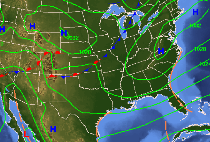
Tag Archives: pressure gradient
Weather Forecast: Cold Front, July 30th, 2017
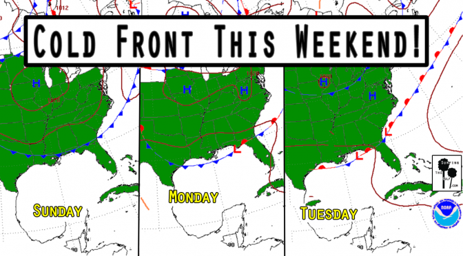
Is it too early to start talking about Fall? It’s not quite Fall, but this cold front doesn’t know that. We’re currently in a pattern of high pressure and light onshore winds with low rain chances. A frontal boundary approaches our area on Sunday. As the front approaches, the pressure gradient will tighten. The tightening pressure gradient will increase the southwest winds. This will increase the humidity and the rain chances. Surf’s up by Sunday afternoon, peaking overnight. Monday the surf continues. The fetch will extend from all the way over by Texas, so the swells should be well formed. The forecast is for 2-4 foot seas at its peak. It’ll be a nice waist high or better swell. The change in the pattern should bring down the temps four or five degrees. Nothing epic, but it could get shortboardable.
The Spring Cold Front Pressure Gradient
It’s nearly here! Are you excited? I’m excited! Who knew weather could be so exciting? I think many of us are eagerly and enthusiastically awaiting the swell! We’re less than 24 hours from really fun surf!