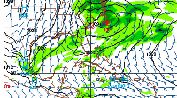
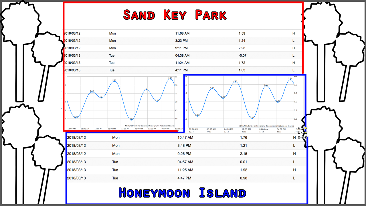
A stronger cold front is comin a knockin. Just on our doorstep, Monday afternoon we’ll watch a big cold front move into the gulf. Spring was here for a short while, but it seems to be disappearing into the sunrise as we approach the middle of March with water temperatures down below 65° again today. Monday around mid-day surf will be rising towards heights of head high. Monday evening the surf peaks with the biggest waveheights and warmest temperatures. Tuesday morning will be a smooth morning at south facing beaches. Around 3am the winds shift from the northwest to the north leaving a northwest swell with offshore winds and temps in the mid 50s.
Tag Archives: gulf coast surf forecast
Nate’s On His Way
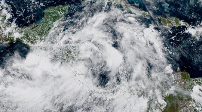
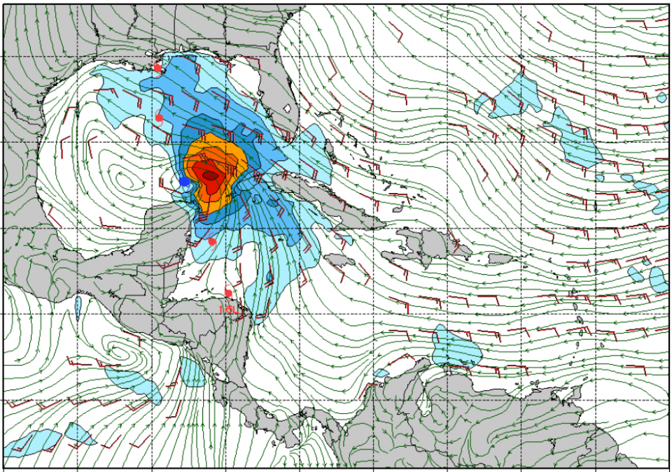
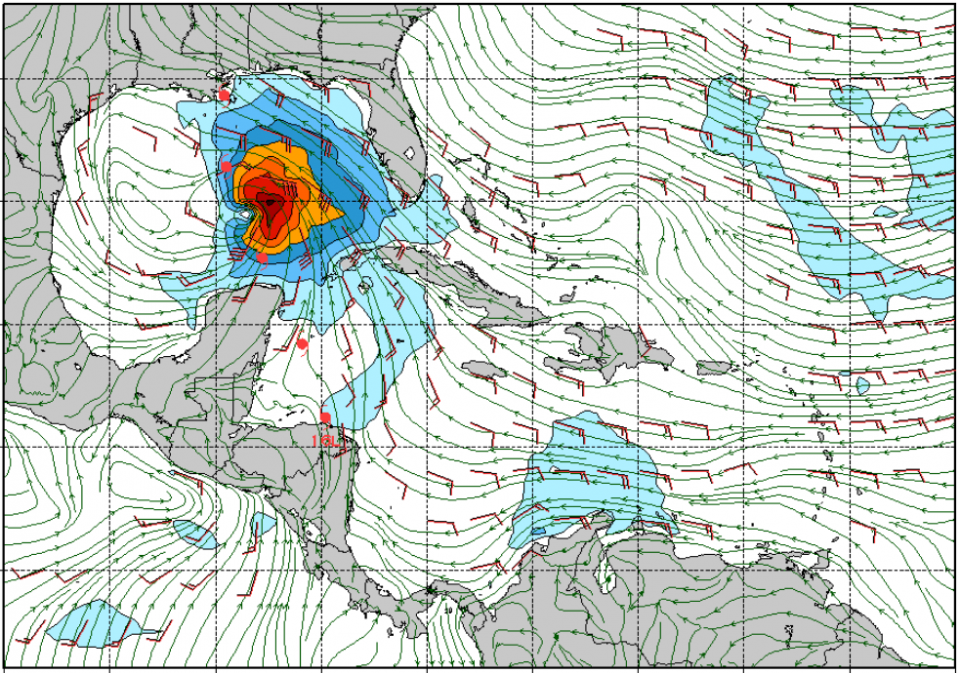
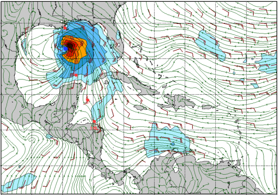
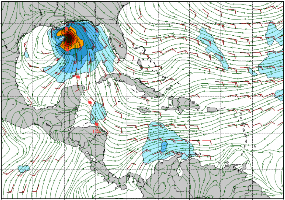
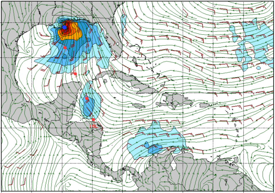
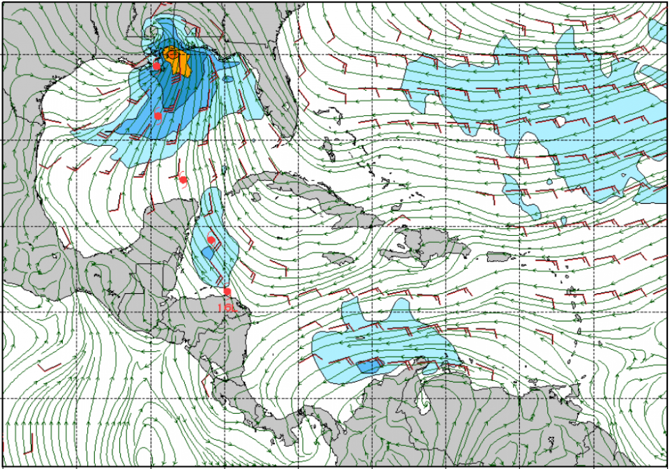
Tropical Storm Nate is just south of the Yucatan Peninsula . It’s traveling at 21 mph and has maximum sustained winds at 50 mph. So this tells us that it’s a super fast moving storm and that there are significant winds associated with the storm. The storm tracks into the gulf tomorrow morning and blasts through in only a day, as smaller storms often do. The wind direction and placement tomorrow morning by 6am down in the Yukatan channel looks conducive for the development of surf, and only gets better from there. We can expect the swell to start filling in sometime mid-day or early afternoon tomorrow. There should be really fun surf. At the swells peak on Sunday the surf could get up to head high with gusty winds at times. The close proximity of the storm and strength of the winds offshore favor solid surf.
GFS Run (noon Fri), Showing 6am Sat thru Noon Sun:
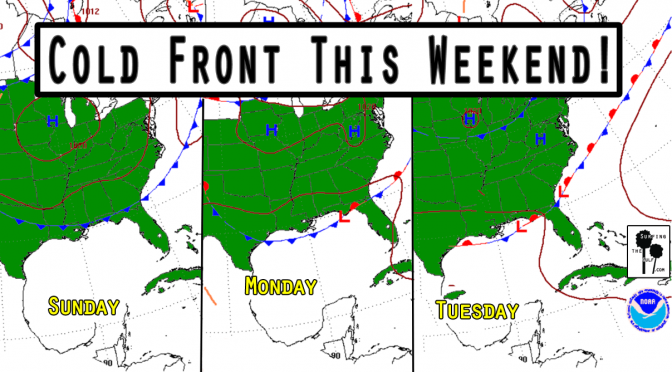
Weather Forecast: Cold Front, July 30th, 2017
Is it too early to start talking about Fall? It’s not quite Fall, but this cold front doesn’t know that. We’re currently in a pattern of high pressure and light onshore winds with low rain chances. A frontal boundary approaches our area on Sunday. As the front approaches, the pressure gradient will tighten. The tightening pressure gradient will increase the southwest winds. This will increase the humidity and the rain chances. Surf’s up by Sunday afternoon, peaking overnight. Monday the surf continues. The fetch will extend from all the way over by Texas, so the swells should be well formed. The forecast is for 2-4 foot seas at its peak. It’ll be a nice waist high or better swell. The change in the pattern should bring down the temps four or five degrees. Nothing epic, but it could get shortboardable.