A low is expected to spin up by Monday afternoon or Tuesday. Tuesday mid-day the west swell spinning off the center of the low should be reaching the coast. The weather change looks like an increase in the rain chances, humidity, and a strengthening south wind. We’ll be surfing the gulf in this precursor to the hurricane season.
Tag Archives: west Florida surf forecast
Latest Model Run Shows A Chance of Surf This Wednesday, Thursday
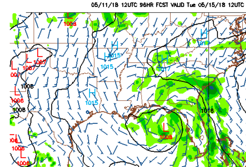
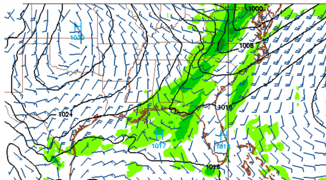
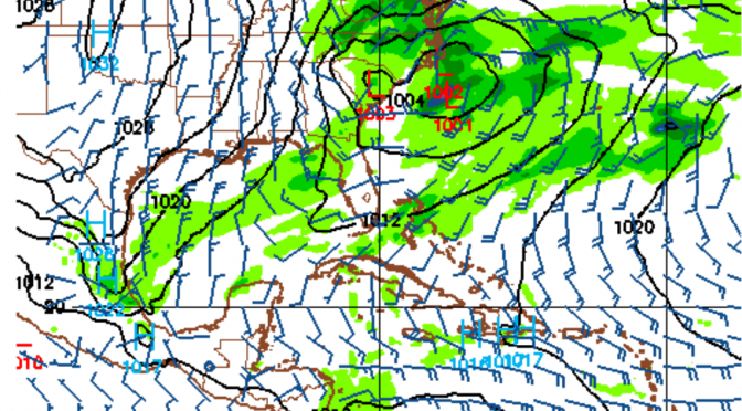
What will happen this week appears to be up for discussion. Will this little front hold for long enough to keep the gradient in place on Wednesday into Thursday. Most of the runs have been showing a weak south wind before the front; then when it switches wind direction behind the front it appears to be going mostly northeast. The models seem to be out of wack this season. Every front is showing up as a northeast wind behind the front, but most of the time they’ve been wrong. Northeast winds would suggest no surf, but something is happening in the gulf where enough onshore winds have been present. Surely a pressure change is not enough to create surf, or is it?
Typically, Spring fronts are known to make surf. When the surf is in season, you can usually depend on surf to be created from a cold front. The other fairly predictable thing that we usually observe is, if there’s a cold front with enough southwest winds to make surf, you can usually bet there’s going to be a northwest swell behind it of some kind, usually at least as big as the southwest swell preceding the cold front. That last cold front was sort of the exception to the rule.
According to the latest weather model run, 15 knot west northwest wind comes up near the Louisiana/Mississippi region of the gulf and shifts eastward as the front steams along. As the front pulls out it pulls the winds to the north. This scenario is likely to create a small west or north swell sometime between Wednesday afternoon and Thursday morning.
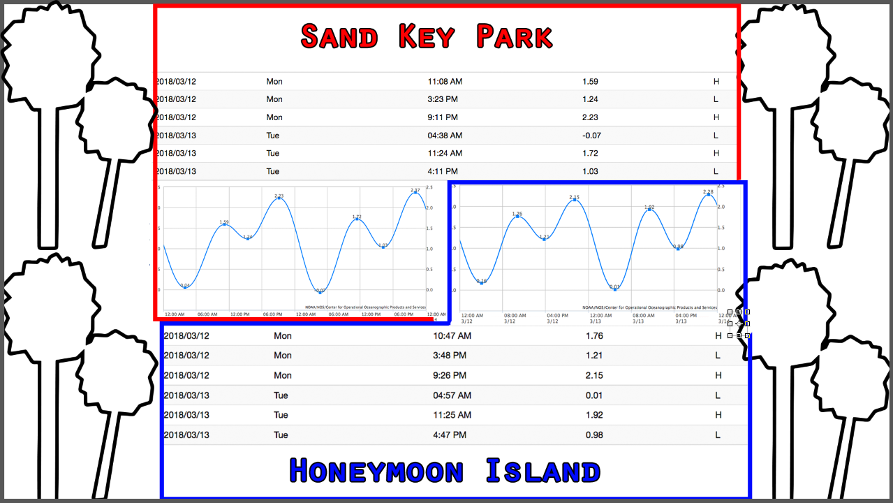
Cold Front: A Big One On Monday 03/12/2018
A stronger cold front is comin a knockin. Just on our doorstep, Monday afternoon we’ll watch a big cold front move into the gulf. Spring was here for a short while, but it seems to be disappearing into the sunrise as we approach the middle of March with water temperatures down below 65° again today. Monday around mid-day surf will be rising towards heights of head high. Monday evening the surf peaks with the biggest waveheights and warmest temperatures. Tuesday morning will be a smooth morning at south facing beaches. Around 3am the winds shift from the northwest to the north leaving a northwest swell with offshore winds and temps in the mid 50s.