Here we’re just talking about surfing. This is going to be your all you need forecast. You’ll get all the nitty gritty details of what’s going to be happening when the surf comes up. From the start of the swell to the end of the swell. Here it comes. If you don’t want to read all this, the summary is at the bottom.
At the present moment (2pm on Saturday) Alberto isn’t even in the gulf. So, the storm hasn’t even started to create surf down by Cuba yet. Down there, there just isn’t anything happening. Right now, the wind in front of the storm is going from east to west. So that absolutely ridiculous hint from other surf forecasters that surf might “almost” be here is just them screwing with you. Don’t you just hate that, I sure do. “Don’t forget to check it.” So, we’ve still got a while to wait. But, be patient, something is bound to happen.
It really just frustrates the heak out of me when people who know what’s going on just screw with you, because they know you don’t want to hear what they have to say. What’s that telling me? Well it’s just a suggestion that this swell might not be what you think it’s going to be. The odds are that this will just be a little swell at most beaches. That big afternoon outgoing tide is certainly going to play a factor.
This afternoon this super slow moving storm might begin to push its little eye wall out into the gulf where it can start the “wave machine”. But, again, it’s really slow moving right now, and actually odds are it’s a little weak. And odds are it’s not really going to be a “wave machine” at all. The eye looked like it broke apart a little bit overnight. It may have lost some steam.
Again, the 24 hour wait for swell from waaaaay down there is going to take some time. So first, the storm is going to need to reorganize, which it’s probably trying to do right now. Then, it’s going to need to head out into the gulf a little further, because the storm shifted to the east pretty far overnight.
As time goes on you’ll begin to see swell. There’s a chance that this swell could get over waist high at some point. There may be a point when you can pull out the shortboard and actually use it. You might actually be able to stand up, feel that rocker pop under your feet, the rails dig under the water as you try to find that energized section. You might at some point get enough wave energy moving underneath you to drag your hand across the bottom of the trough in front of the wave as you carve out your bottom turn and head for that steaming section your eyeballing. Sunday evening/Monday should be one of the times when you can put the shortboard under your feet.
It’s going to be one of those nights on Sunday night when you think, if only I was nocturnal. If only the moon were so bright that it was like daytime. I mean, people do surf at night, but it’s usually just too damn dark. All that tasty swell will be flushed down the toilet like the money we spent on sand and sand dunes at Honeymoon Island State Park. Washing onto the beach without a single surfer to ride them, solid swell will go unridden overnight on Sunday night. But don’t fret, it probably won’t be that good.
Monday morning the swell will continue. It’s time to get on the board when Monday morning rolls around. Your work, school, and other obligations will seem obsolete when you see the fun groundswell (with sideshore wind) pumping into your beaches. The boardshorts on, board in hand, fresh coat of warm water wax, and cool water waiting for you to jump right in, all your thoughts and worries should just melt away. That long period when you’re waiting for sets to roll through should be a prime opportunity to set your brain to chatty fun mode and recognize the surfers around you. Don’t jockey too hard, share, because if you don’t you might not be welcome next time. That Monday morning should be fun right up until the 11:30 high tide, and probably beyond. Tides from the 27-29 below for Honeymoon Island State Park.
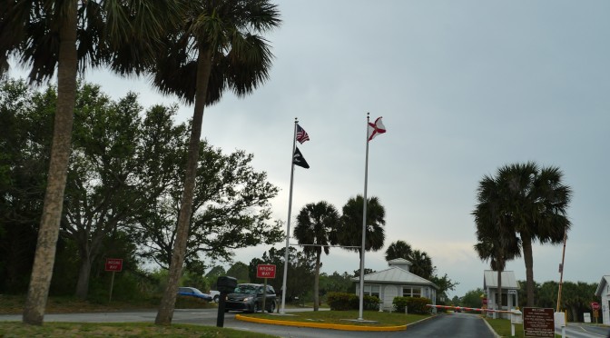
Tropical Storm Alberto Honeymoon Tides
So you’ve got your stoke on. It’s coming up on the heat of the afternoon. Your dealing with gnarly, windy, raining conditions, as you might expect from any average tropical storm that usually occurs during this time of year. Your thinking, will the gnarlyness end? Will this fun swell just go on forever. It might.
Shifting around to different breaks at Honeymoon Island will help you stay on the fun waves as the tides and swell directions change. Often the beach by the Cafe can be fun. It’s really the go to spot for big hurricanes at Honeymoon Island because it’s such a long wave. It really is like the longest wave I’ve ever ridden, longer than Venice, longer than Bradenton, longer than St. Pete, longer than Clearwater. You’d be hard pressed to find a better wave on the west coast of Florida when the surf’s up. If you want a real wave to ride, that’s the one. No scrapping around with a bunch of other idiots thinking, Oh this is going to be good, and I’m going to be the badass who gets it, only to get the good one and realize it actually is a shitty wave. Honeymoon is really long, really empty, really challenging because you actually have to ride it (stay in the sweet spot) or get bogged down, and can even get hollow. Watch out, because last summer, after that dredge, a deep trough and the wonky tide absolutely killed it. But it looks like all that shitty sand is gone, so it should turn on again when the swell comes up. And of course, you can always surf the usual winter groins at north beach and oasis, but again, shifting around as the tide changes is the key to staying on the waves. And don’t forget to share. I know I fall victim to my own selfishness all too often. If you need to go find a different wave, there’s likely to be a few others.
The storm will have gained momentum by Monday afternoon, and should be hitting a wall in the atmosphere, slowing it down. Lucky for the northern gulf because no storm is a good storm when the eye is making landfall right on top of you.
It’s going to remain a solid storm on Tuesday. The funky short period south swell will be rolling through the beaches, 25 knot sustained south winds. Those little swells where it’s super windy and wonky. It’ll be like that, I would think. The eye may still have some swell spinning from the center, so that’ll be good. It could be fun. Small traces of longer period eye swell. It could keep us bigger guys on the shortboard.
Wednesday overnight it goes over land. Wednesday by 6am, it’ll be all but gone, maybe some lingering swell through the day, but I woudn’t count on it being shortboardable. The storm will be over land, and you’ll be all but worn out, I’m sure of it. Rashed up, sunned out, dehydrated, and hungry. It’ll be time for rest. Go home, get back to your regularly scheduled programming. Sleep, eat, work, go to school, and do what stupid bullshit you have to do to to make the man happy. Then, maybe check the surf, and if you see fun groundswell forget about all that and get back out there.
SUMMARY
The storm will blow through pretty quick as they usually do.
The surf from Alberto will begin sometime Sunday afternoon. When the winds get here, the surf won’t be far behind.
Monday should be good all day, a mix of long period swell and short period swell. GUSTY! Let’s try shortboarding at Honeymoon Island on Monday. No longboarders allowed.
Tuesday we’ll have west swell from the storm pulling away, with more onshore wind. Probably pretty small.
Note: Rick Scott just declared a state of emergency. Only Rick Scott. Oh man, 25 mph wind, everyone panic!