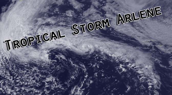
What eventually became Tropical Storm Arlene developed organized convection around 11am on Wednesday, but wasn’t expected to strengthen much as it moved over cold waters (66° or less) with high wind shear. The extratropical low nearby was expected to absorb the depression before it could form. Around 11am on Thursday, as the storm developed a warm core, it became more organized, and the storm began its transition into a tropical depression. Unexpectedly, from 11am to 5pm the storm strengthened into a tropical depression, then into a tropical storm. The initial intensity estimate was 40 knots as thunderstorm activity encircled the eye. At its peak around Friday morning the storm showed maximum sustained winds at 45 knots, and movement in a northwest direction at 28 mph. Late on Friday morning Arlene quickly deteriorated as cool air from the nearby low increased. The storm was eventually absorbed by the extratropical low.
Arlene is the second tropical storm to form in April since we have been able to monitor the north Atlantic with satellites. This storm is unique, because it formed so early in the season over surprisingly cool waters.
A quick clip from the GOES Satellite showing the dissipation of Arlene:


