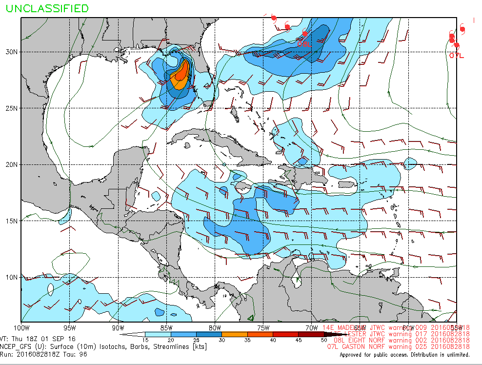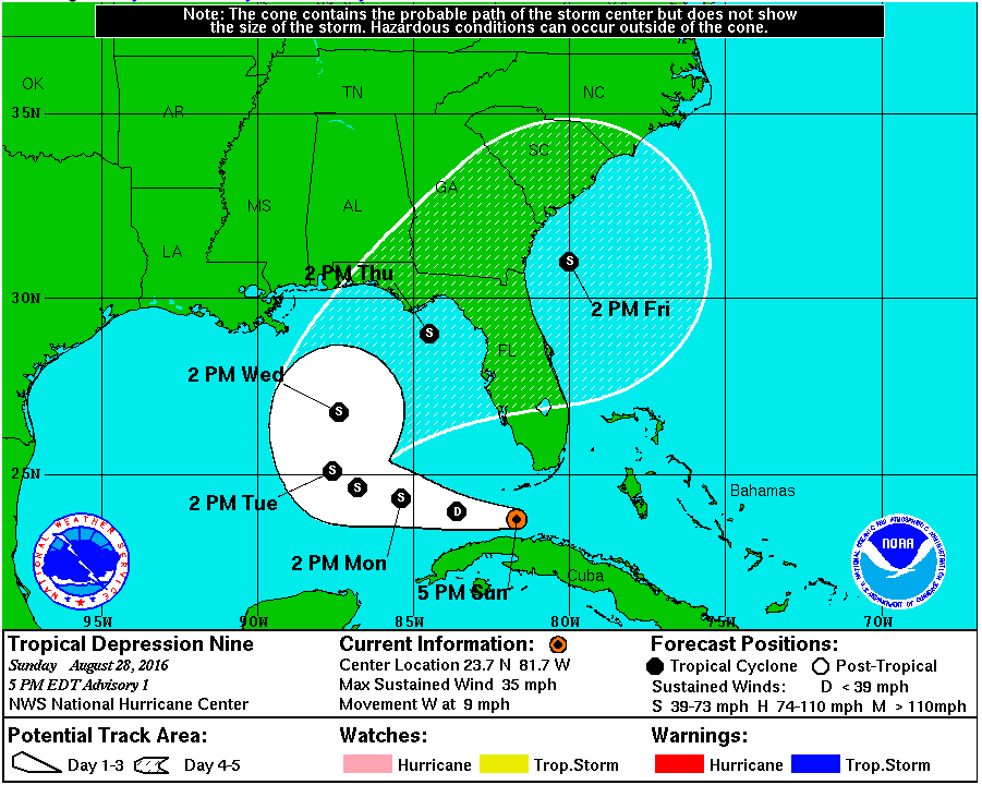
What was Invest 99L now has a well defined center of circulation, so we are instead talking about something categorized as a tropical cyclone. This storm is called tropical depression nine, and soon Tropical Storm Hermine. The Hurricane Hunter found the lowest pressure of the circulation at 1009mb, and the strongest estimated wind speed at 30 knots (34 mph). The intesity is not expected to increase within the next day, due to an enviornment ripe with wind shear. The national hurricane center is predicting this storm’s intenstiy will peak at around 45 miles per hour.
Surf Forecast:
On Tuesday afternoon the surf will start to get fun. It looks like waist high plus surf with offshore winds, 2-3 foot at 6-7 seconds. Wednesday the surf gets a bit bigger, around 2-4, and the wind starts coming from the south (15knots). Thursday becomes west southwest swell (4-6) as the storm moves north in the gulf. Strong onshore winds will keep the surf mixed up. Things might get kinda gnarly on Thursday night as the storm collides with our area. Friday morning the swell will continue to be a solid 6-8 foot with southwest winds at 20knots. During the larger surf I recommend exercising caution.