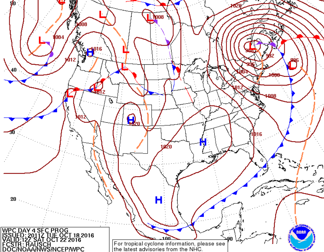
On saturday, after the low drags the cool air mass across the gulf, we are still looking at a powerful 988 millibar low pressure system in the northeast, and a cold front boundary almost as far south as the Pacific Ocean.
Wave Models
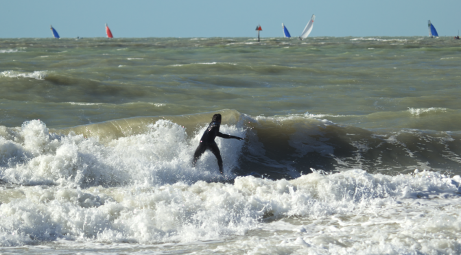
The swell should peak sometime on Saturday.
Weather models are useful tools for predicting surf. Using the swell models, we can look at a projection of the swell headed toward the coast about a week ahead. The swell we see on those models is usually a good indicator of what we will see on the nearshore buoy. Because the wave models give us a good idea of what is going to happen on the nearshore buoy, and the nearshore buoy is a good indicator of what we will see at the beach, the wave models are a good way of gauging the size and quality of surf in the future.
Wavewatch is showing the wave heights peaking at 4-5 feet with 6-8 second periods.
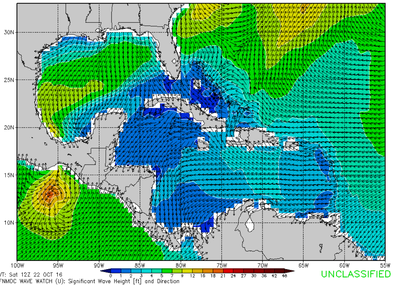
Simulating Waves Nearshore (SWAN) shows the peak wave heights at 4-5 feet with 6-8 second periods. However, SWAN is showing a mix of larger north swell headed south. A pulse from the north swell is not unlikely.
As you can see the wave models have some inconsistency in the wave direction, but are quite consistent in the size of the swell headed in our direction.
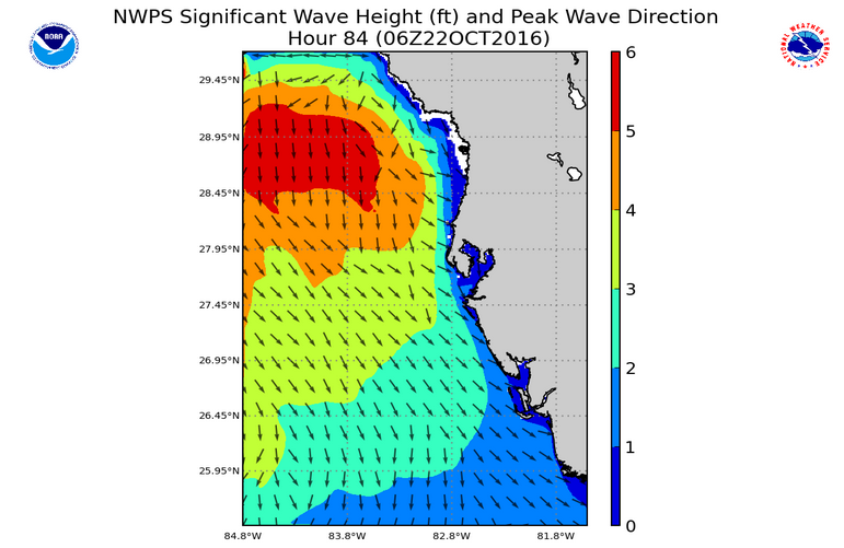
Seas Forecast
On Saturday the seas forecast from Englewood to Tarpon Springs are projected at 2-4 feet. On Sunday the seas are still projected to be 2-3 feet.
Wind Forecast
Forecasting wind direction and strength can be a challenge. There is very little consistency between forecasters and forecast tools regarding the wind direction. You can very often only get an accurate wind prediction around 24 hours out.
According to the seas forecast, there will be a north wind at 15 knots on Saturday. On Sunday, there will be a northeast wind at 10 knots (the cleanup).
The Weather Channel is suggesting the winds will be north on Saturday at around 11 miles per hour. Remember 1 mph is slower than 1 knot. Sunday the winds are projected to be from the east northeast at 9 miles per hour.
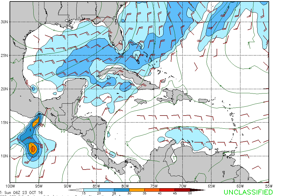
Here is Sunday at 6am according to the GFS:
Water Temperature
The water temperature from Clearwater, Florida to Venice, Florida is currently 80 degrees Fahrenheit.
It wouldn’t surprise me if by Saturday morning the water temperature has dropped a degree or two. Then, by Sunday morning, the water temperature may drop two degrees more.
Air Temperature
Air temperature is often a good indicator of the strength of a system. Behind this front you can expect to see daytime temperatures drop around six to seven degrees. The Sunday morning low temperature will be a chilly upper 50s!
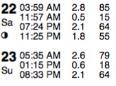
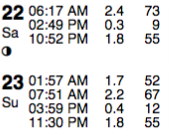
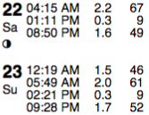
Tides
Clearwater Beach:
Saint Pete:
Anna Maria Key:
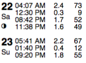
Venice:
One final thing I want to mention is that a lot of these estimates are like giant averages. These are aggregations of massive data sets. These are summaries of data with a very high amount of variability. Essentially, these estimates are just an overview of the general pattern of weather conditions in constant flux.


