Ready to play? Tuesday and Wednesday look good to me. Wednesday might be a little tough to manage, but it should still be pretty fun. 12-15 means chest high and super windy, in case you aren’t up on NWS terminology. There could potentially be surf on Thursday with light winds if the timing sticks.
Tag Archives: weather forecast
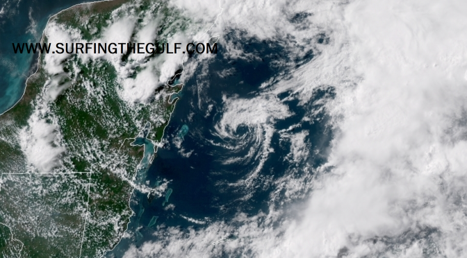
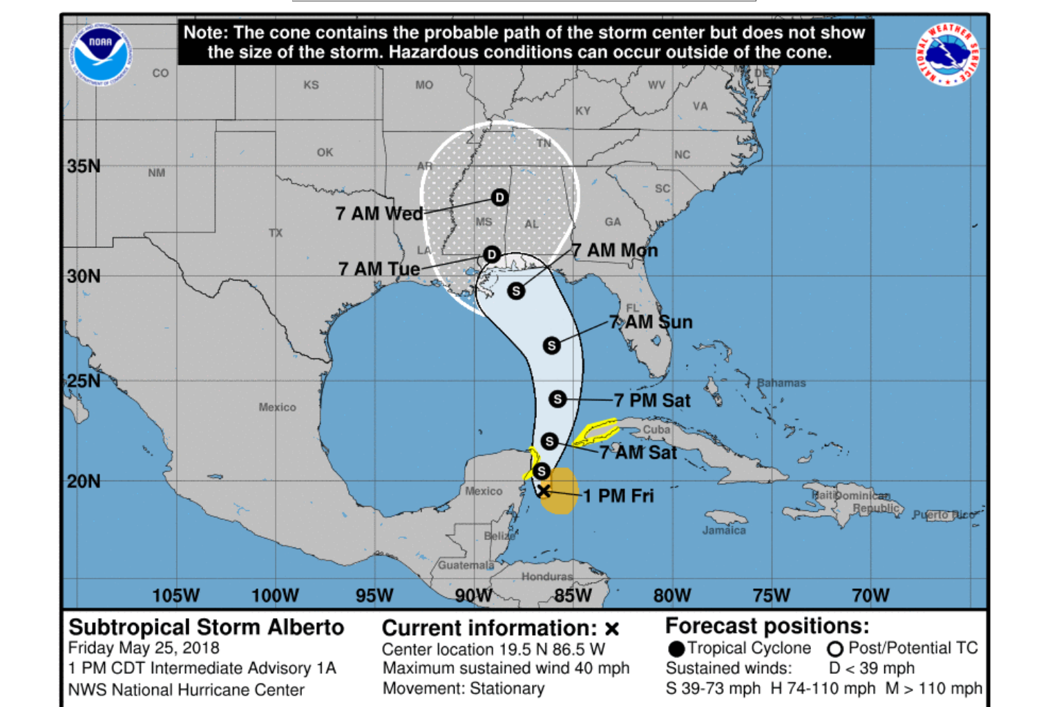
Newly Formed Tropical Storm Alberto
The storm that was a low pressure system is interacting with a sharp upper level trough, and that low is now called Tropical Storm Alberto. Ship and Buoy observations are providing the data for the upgrade to Tropical Storm Strength, measured at about 35-40 knot winds. The Hurricane Hunters were scheduled to further investigate the storm, and are likely in the air right now collecting more measurements. The storm center has more than one low pressure area. Moving slowly north northwestward, the storm is expected to increase momentum in the next 36-48 hours, likely leaving it in the lower gulf to spin and create longer period south swell that is likely to take nearly a day to get here. The storm is currently encountering shear, but is expected to strengthen some as it moves over the gulf. The west coast of Florida will be experiencing an increase in wind strength and rain chances, with potentially gale force gusts. The storm is expected to slow again as it nears the northern gulf around Monday morning, again allowing the storm to continue creating surf, and sending it toward the coast. This will be an extended pattern of long period swell, potentially days of groundswell, with offshore or side offshore winds. Please note: it’s way, way more likely we get onshore winds associated with the storm (statistically speaking).
Weather Forecast: The Next Cold Front Edging Closer
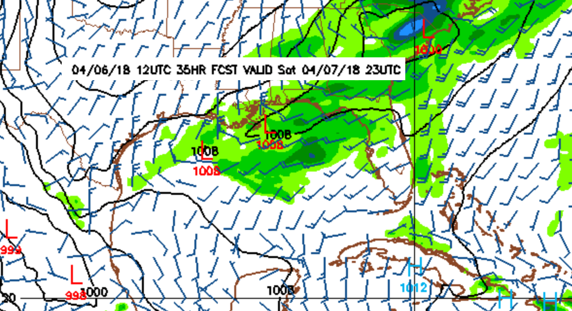
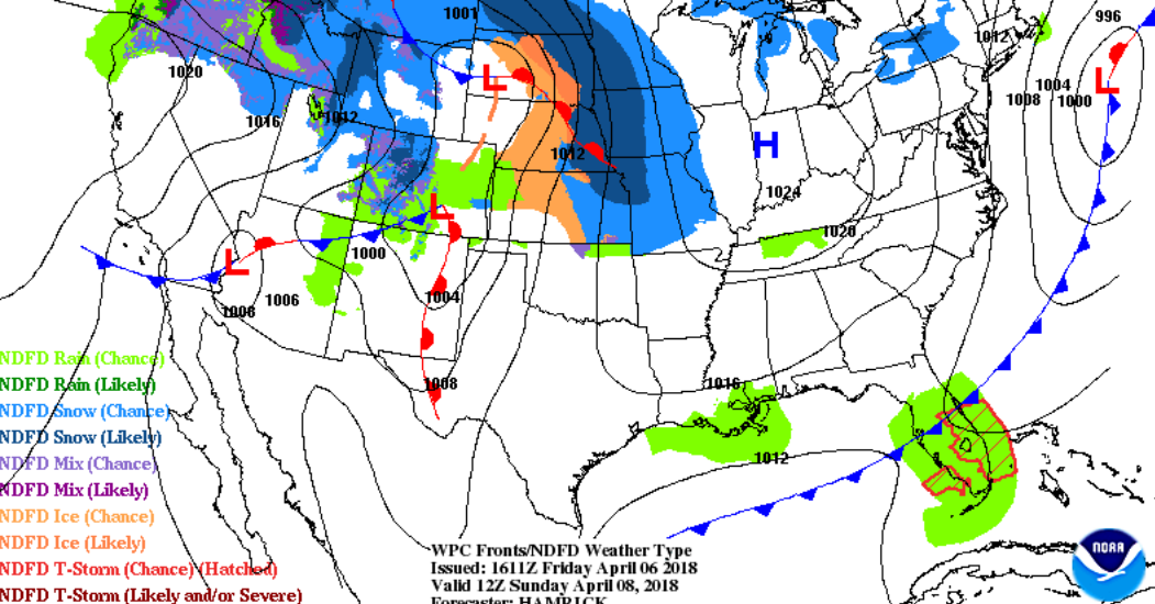
Tomorrow morning the winds come up from the south southwest. As the front gets closer, closer to the afternoon/evening, the winds shift slightly more southwest, and increase in strength up to around 15 knots. The afternoon/evening is when we can expect the decent little swell to start filling in. Overnight the front passes and the gradient tightens over the northern gulf. The alignment of the gradient will pull the winds into a westerly and west southwest direction; the winds shift west above the 1012 line, and west southwest/southwest below the 1012 line (image 1 below). So, breezy on Saturday, and overnight Saturday night. The winds start south and shift west as the front gets closer passes, then northwest/north winds fill in behind as the front pulls out. The winds could be moderately strong, around 20 knots overnight. By morning, the winds go pretty much slack. Whatever swell is leftover should linger through the morning. The temps don’t change much from the low 80s, and the water is right around the low 70s. The temperatures look pretty comfortable for this one. I wouldn’t miss it. It won’t be anything like a hurricane, but it looks like fun!
1:
2: