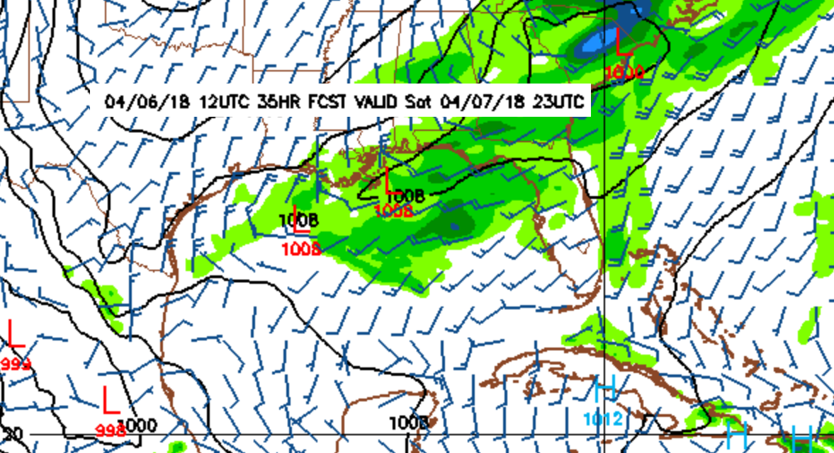
Tomorrow morning the winds come up from the south southwest. As the front gets closer, closer to the afternoon/evening, the winds shift slightly more southwest, and increase in strength up to around 15 knots. The afternoon/evening is when we can expect the decent little swell to start filling in. Overnight the front passes and the gradient tightens over the northern gulf. The alignment of the gradient will pull the winds into a westerly and west southwest direction; the winds shift west above the 1012 line, and west southwest/southwest below the 1012 line (image 1 below). So, breezy on Saturday, and overnight Saturday night. The winds start south and shift west as the front gets closer passes, then northwest/north winds fill in behind as the front pulls out. The winds could be moderately strong, around 20 knots overnight. By morning, the winds go pretty much slack. Whatever swell is leftover should linger through the morning. The temps don’t change much from the low 80s, and the water is right around the low 70s. The temperatures look pretty comfortable for this one. I wouldn’t miss it. It won’t be anything like a hurricane, but it looks like fun!
1:
2: