This article includes the details of this strong cold front moving through the area on Sunday. It covers west Florida, east Florida, Pensacola in the panhandle, and Texas.
Regional:
Sunday morning on the east Florida coast the surf will be side-shore swell with offshore winds. Saturday, Sunday, and Monday are all about waist to chest high with strong offshore winds.
The panhandle has had small onshore surf all week. Saturday evening could get larger, around chest high. Sunday by mid day the surf gets even bigger, overhead high. Early Monday morning the surf is waist high plus with side/offshore winds in Pensacola. This is a solid wave-maker for the Panhandle.
Texas isn’t seeing much from this front. Seeing as it’s entering the gulf from the western portion, over near Texas, the winds will be offshore for the area.
WCFL Summary:
Saturday is waist high in the evening. It’s partly sunny with a small chance of storms. Sunday the surf gradually get’s larger and larger. The skies continue to be overcast with the arrival of the front. Monday the wave-heights peak at 10 feet or more from the strong onshore winds. The day will be stormy. Tuesday looks fun. It’s waist high with moderate to light onshore wind.
The lowest daytime high temperatures are 70° on Monday. The overall weather doesn’t get ridiculously cold like the last one. Current water temp: 67°. The winds are going to be from the southwest and west through this cold front.
WCFL Detailed Surf Forecast:
Saturday afternoon the surf looks about waist high by afternoon, coming up from the south-southwest.
On Sunday morning the surf is southwest. It shifts to a large west -southwest swell in the afternoon, big by evening. This is when the front is moving through the middle of the gulf. Bay News 9 is showing a 70% chance of rain. The swell will increase in size as the day goes on, going from 5-7, 7-9, then 9-12 foot. The increasing waveheights are a product of the wind increasing from 20 knots to 30 knots. 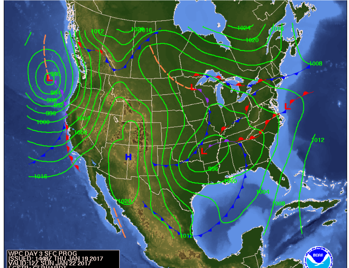
Monday is a gusty day with big surf. The wave-heights are in the 10 foot range, and could get considerably larger. After the front passes the big west swell fills in. Monday stays about the same all day.
Monday overnight/ morning the wind may get 35 knots, and by Tuesday morning there will still be surf left. The winds are light/moderate onshore in the afternoon/evening. The morning will be biggest. It’s going to be about head high plus on Tuesday morning.
That’s your surf forecast for the next 5 days.


