The front is into the gulf. The boundary is almost upon us. The boundary hasn’t quite reached the 036 buoy. The buoys and Goes satellite are showing some interesting things.
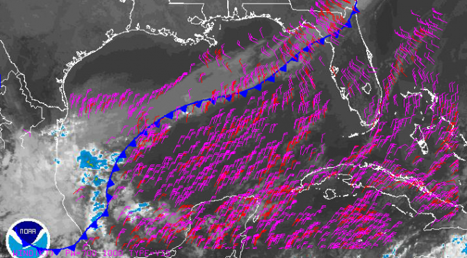
You can see on the GOES satellite imagery (below) an interesting and unusual feature of the cold front. The feature of not only this front, but also a pattern we have been seeing with all the frontal systems this season, the winds in front of the boundary are from a northwesterly direction. Cold fronts commonly lead with a south wind preceding the cold front boundary. This season we have been seeing the northwest winds arrive before the boundary, and strengthen after the boundary has passed.
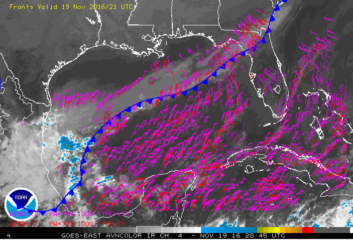
Right around 5 pm this afternoon the wind speed on the 036 buoy was at 15 knot sustained winds, and up to 19 knots gusts from the NNW. This was well before the boundary had crossed the buoy.
The most interesting thing about this is the simple fact that the NW winds have been starting before the frontal boundary. This puts the timing of the waves and the wind in an interesting relationship. The winds seem to be timed just right, timed in a way that the NE winds that usually follow behind the front arrive a little earlier in the wave window. This makes it so the surf will still be pumping into the beaches when the winds switch out of the northeast.
This is a very interesting pattern. It is the the ideal pattern for gulf surfers who are stoked on offshore winds, and blue skies.