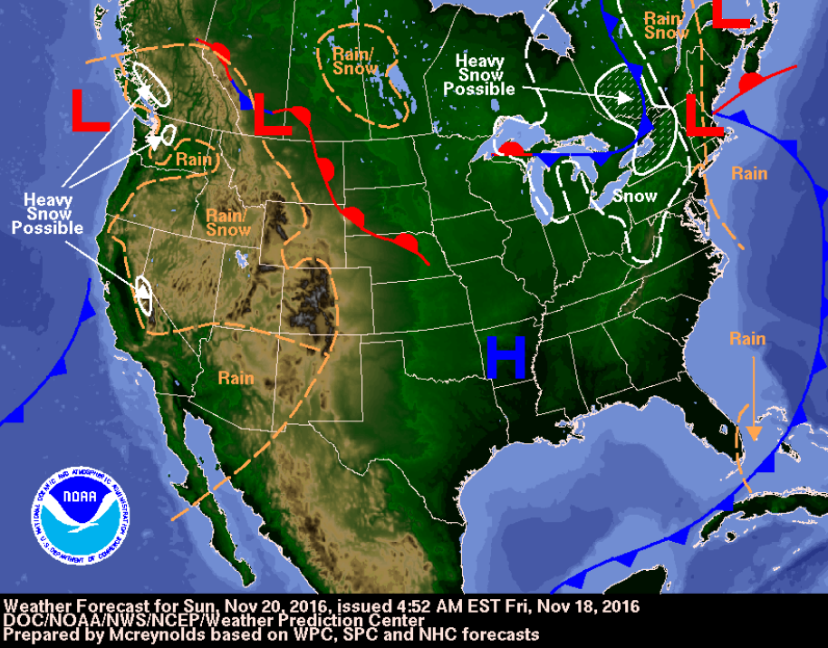
There is another epic cold front headed for the gulf coast. What makes this cold front so unusual, you ask. Well it is the northeast winds paired with solid surf, of course! This solid cold front is slated for Sunday.
This is a cold front surf forecast for Florida’s gulf coast. This forecast will cover things like the waves, the weather, and the tides for Clearwater, Bradenton, and Venice. It will discuss how these conditions will change through the duration of the swell.
Timing:
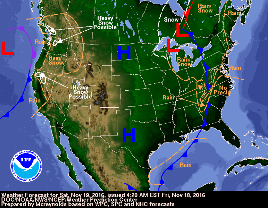
This front moves through overnight, between Saturday and Sunday. The swell arrives Sunday morning, and lasts through the whole day. Monday morning consists of traces of swell, but the surf will be all but gone.
Conditions
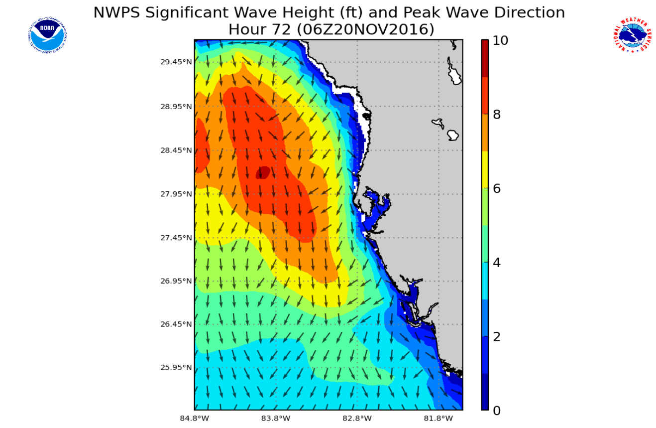
Swell: SWAN and Wavewatch show surf from a northwest direction (probably a good average). Bay News 9’s model was showing west swell coming from over near Texas. The winds are forecast to be north and northeast. It is possible that a mixing of west swell, northwest swell, and north swell will be along the beach.
[pms-restrict message=”Register for a member account or sign in to view the full cold front forecast for Sunday, November 20th, 2016″]
On Sunday morning, the nearshore buoy could reach maximum surf at 9 feet heights paired with 6-8 second periods. That is solid surf. The surf will definitely be up. The sets should be decent, but the northeast winds will probably inhibit the surf some. Seas are forecast to range from 6-10 on Sunday. The waves will be in a dropping trend by mid-morning. After mid-morning the swell will gradually begin to diminish.
Winds: The weather channel has the wind forecast at northeast by 6am. SWAN says the winds will be north in the morning, north northeast by midday, then back to north by evening. SWAN shows the winds up to 20 to 25 knots in the morning, and 15 in the afternoon.
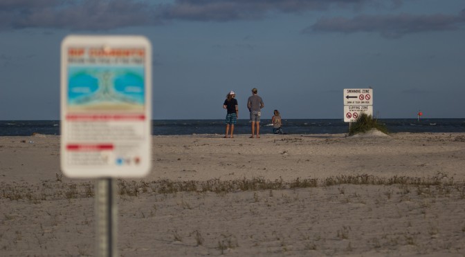
Water: The water at Pier 60 is at a cool 69.1°f. That is borderline full-suit temperature, but it may still be bare-able in a spring-suit depending on how much body fat you have to keep you warm. Venice is slightly warmer, the water temperature in Venice is just under three degrees warmer, right around 72°f.
Skies: The skies are going to be clear and sunny on Sunday. The ultraviolet index is still quite high, so don’t forget the sunscreen. Sunscreen is useful through the entire winter in Florida, particularly during long sessions.
Air: The air temperatures will be cool. Overnight on Saturday the air drops into the mid 50s. Once the sun comes up and because of the clear skies, the temperatures will warm up quickly. A fullsuit may be needed on Sunday. I know I’ll be in a fullsuit. The air may reach the upper 60s on Sunday.
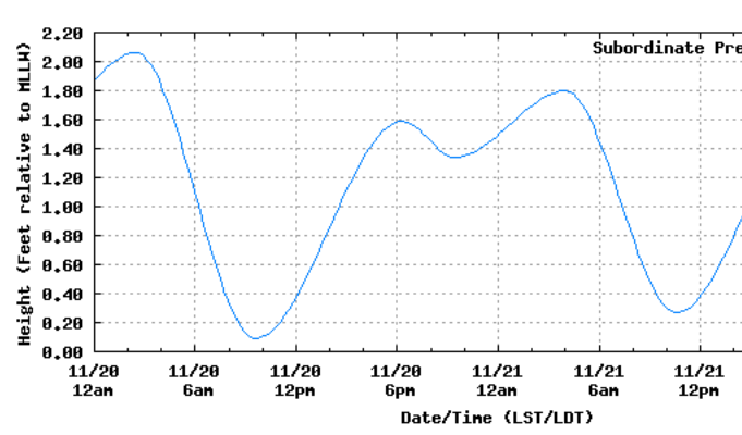
Sunday Tides:
Monday Morning:
There won’t be any rideable surf left by Monday morning. The periods drop significantly and the wave-heights fall to 3-4 feet from the north. The air be in the mid to low 50s.
Summary:
Overall this is looking like a super fun swell. Northeast winds are about as clean as the gulf gets in the wintertime after a cold front. 9 foot wave heights should generate fun surf, and certainly a barrel or two. The water is still relatively warm, right around 70 degrees. The tide should start coming in right around the swell’s peak. Sunday morning is looking like another epic winter swell.
[/pms-restrict]


