~Weekend Cold Front~
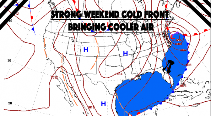
A cold front is dragging a cool air mass across the plains. It is expected to interact with Hurricane Matthew by late in the week. By Sunday the trough will have dropped below west Florida.
Strength Indicators
The winds behind this cold front are not bad. The winds should blow 20 knots or more. After the front passes us, after it passes the entire state on Sunday, the strength of the low remains strong at 998mb.
Surf Forecast (Saturday/Sunday)
The surf behind the front is likely to be around waist to chest high.
Temperature Change
Behind the front we continue with our cooling and dehumidifying trend. The temps drop 10 degrees behind this thing. Behind this front there will be even drier and cooler air than we have been experiencing.
Potential for Interaction
As the cold front and this strong hurricane merge there is the potential for extremely high surf late in the week, but that will depend on the Hurricane’s track.


