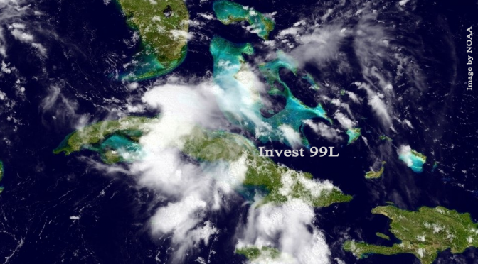
I would like to give you a concise statement with a detailed description of the multiple day swell in the works, but at this point the various models and meteorologists are uncertain what this storm is expected to do and where it is expected to go. The hurricane hunter aircraft is going to investigate the storm this afternoon. We should know a little more about the storm later today or this evening.
We can certainly expect some swell from this thing. At this point, the beginning of the wave window is on Tuesday, when the south swell spots turn on. It could get waist high with offshore, southeast wind. Then the swell turns gradually south southwest on Wednesday with more of an east wind. Thursday and Friday is showing some conflicting information. The surf could get big and windy, or it could go flat. Really, we need to wait until this afternoon to see what this storm is going to do. We’ll definitely see some semblance of swell, and stormy weather, and hey, who knows, maybe it’ll get really fun if this storm gets its act together. All in all, the northward track just off the coast is a good track for creating large west Florida surf.


