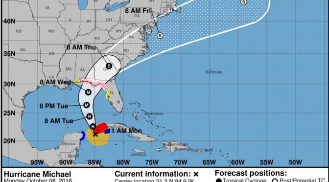
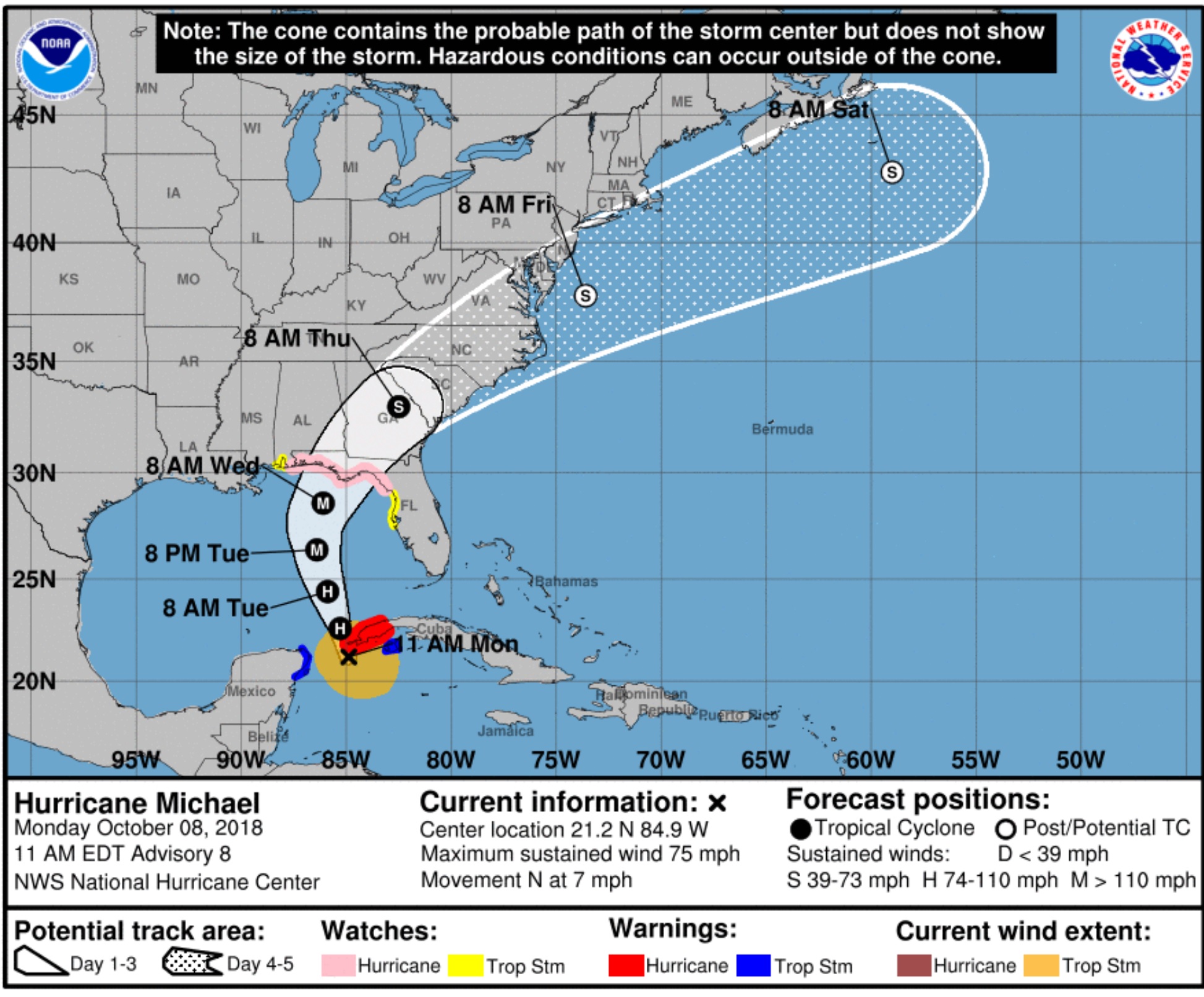
In the latest update from the National Hurricane Center the surf producing storm churning down around the Yucatan Peninsula is currently at category 1 status. Michael has a maximum sustained winds of 70 miles per hour. It’s currently a 982 millibar storm, actually quite strong, and it’s only going to get bigger up until the point where it makes landfall. Michael is forecast to become a major hurricane by Tuesday or Tuesday night. We can expect a large storm surge and large surf generated by this major hurricane. We might even see Honeymoon Island break into two islands this week. This will probably send the red tide up toward the panhandle and north Florida area, you can rid the red tide goodbye. The surf from Michael is going to be good sized surf through the entire event. It’s going to come up quick, and it’s going to drop quick. You can expect this thing to start off with offshore winds, then turn south, then west as the storm moves up into the northeast. Expect waist-chest to way overhead high through most of the time when the storm is in the gulf.


