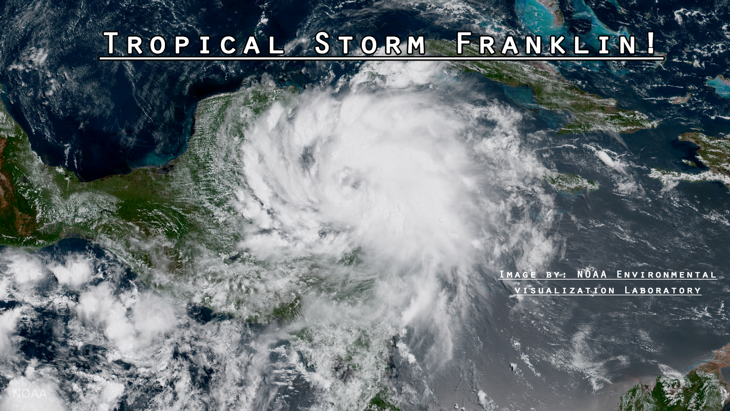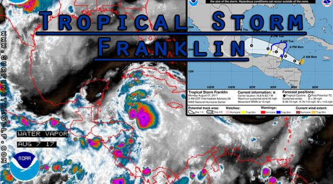
We have a newly formed tropical storm this morning. Tropical Strom Franklin was looking good right from the moment it exited the African peninsula. It lost its shape while moving through the Atlantic. It began to reform within the past day or two. Today, as it nears the gulf, it has enough of a spin to be called a tropical storm. The eye is located just west of the most severe weather, just left of the oranges and purples in the picture above. At 2am the maximum sustained winds were up to 45 mph. Franklin is expected to strengthen before making landfall on the Yucatan Peninsula. The storm will reenter the Gulf of Mexico for only a brief window before land-falling again in Mexico. This storm isn’t expected to generate any significant surf. For the next couple days the rain chance is around 40%, mostly at the coast, and caused by the afternooon sea breeze. The skim could get fun on Tuesday evening or Wednesday from a small Yucatan channel/south swell in west Florida.
Texas should be seeing upwards of 6-8 foot swell, possibly bigger, and 5 to 10 mile per hour winds. The afternoon on Thursday will be the swell’s peak. Friday morning 5 foot long period swell will be left over. There’s also low rain chances through the week. It should be a really fun swell.