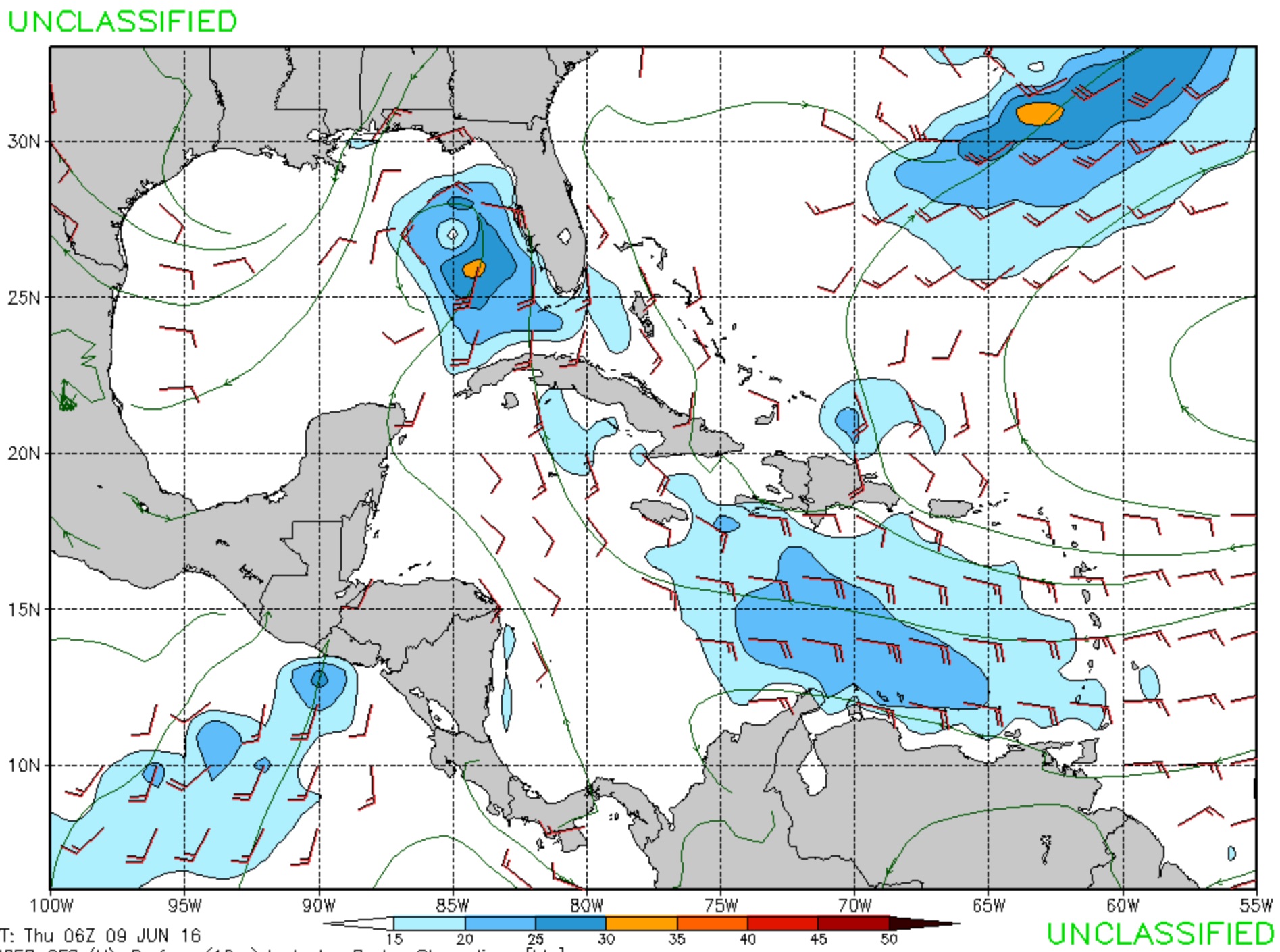
Here’s that image from the GFS of Tropical Strom Colin. Colin turned out to be a really fun storm. That windy day wasn’t outstanding at the beginning, but after the tide started to drop the waves started to really take shape, and the waves became decent for a swell coming directly from the south. It seems there was enough of a southwest component to get the sandbars going up here. Then, when the winds went slack and the skies began to clear the waves glassed off, turned a greenish color, and began to pump like a wave machine produced wave. What was interesting too, is, there were quite a few people out surfing for both days. And, it wasn’t too crowded, because of the variety of different waves breaking along the new jetties. A Colin quality storm is what we can usually expect for the early portion of hurricane season.
Now, we just are hoping a big one moves into the gulf; Not a storm so big that causes mass destruction, but big enough to send overhead high swell. The east coast is sure to get hurricane swell in the coming months. Ideally, a big storm heats up in the middle Atlantic, generating a powerful center with strong winds, which sends fun surf. Then the storm goes into the north Atlantic, dissipating in cool water. Here on the gulf we can expect a few decent days during the summer, but the surf doesn’t get really consistent again until wintertime, around late October, early November.


