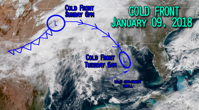
Just like the recent nor’easter, the cold front over northern Texas is headed for the Gulf of Mexico. Despite this system heading right for us, the trend for this upcoming cold front is actaully a warming trend, and the storm won’t be impacting the temperatures at all. This low will be entering into the gulf near Floribama, the Florida panhandle area, then continue on its southerly track through the gulf. I’m expecting the low to be completely gone by the time it nears the north-western tip of Cuba on Wednesday evening. As this storm moves through the gulf it’s likely to kick up a west swell in response to a tightening pressure gradient along the frontal boundary. What cooler air there is behind the cold front won’t be reaching the Florida coast. Expect slightly more humid south flow to be drawn towards us. The warming trend will continue through the surf on Tuesday afternoon. The water and air temperatures are warming, however the water will still be very cold. This low pressure cold front will be another fun little swell before the significant wavemaker next weekend.


