Tag Archives: Fall 2017
Nate’s On His Way
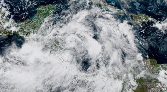
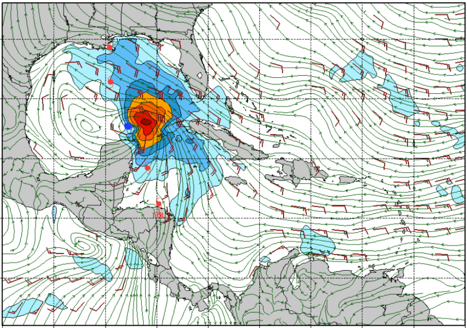
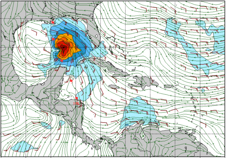
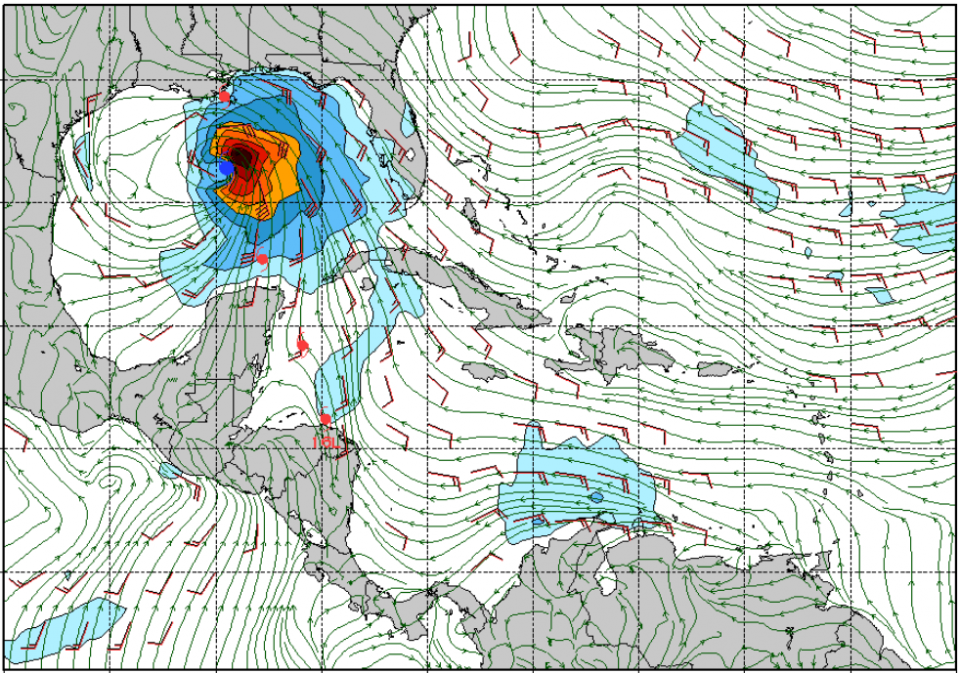
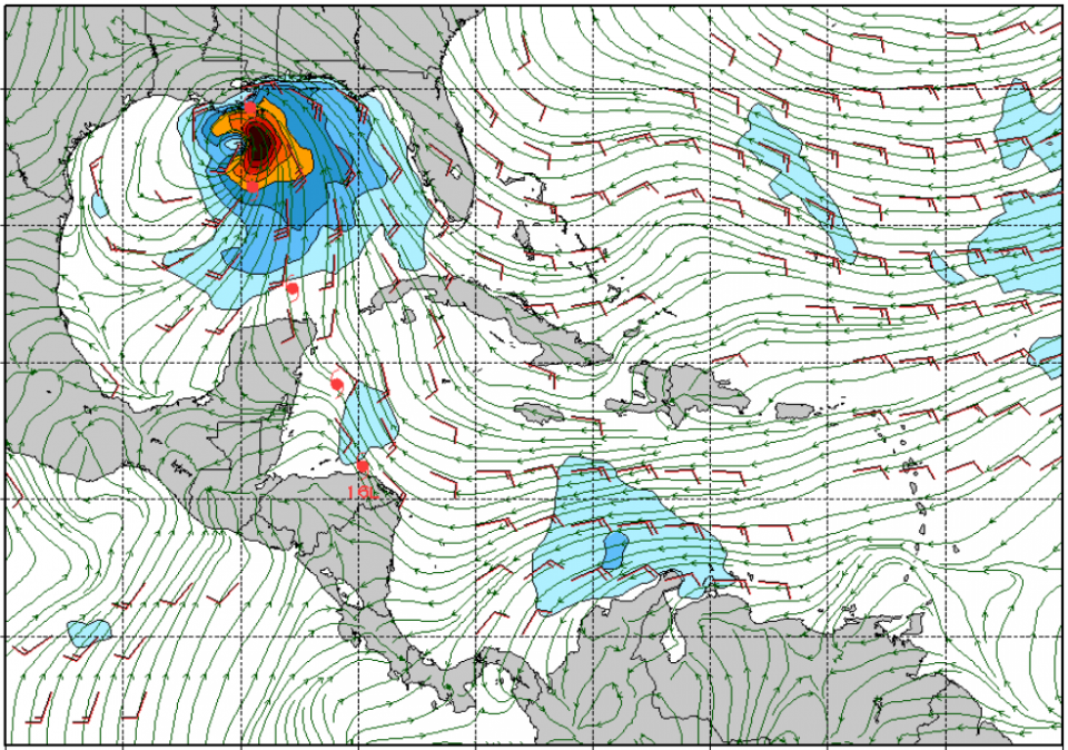
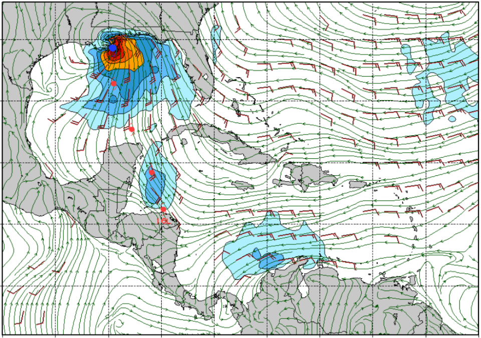
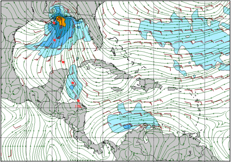
Tropical Storm Nate is just south of the Yucatan Peninsula . It’s traveling at 21 mph and has maximum sustained winds at 50 mph. So this tells us that it’s a super fast moving storm and that there are significant winds associated with the storm. The storm tracks into the gulf tomorrow morning and blasts through in only a day, as smaller storms often do. The wind direction and placement tomorrow morning by 6am down in the Yukatan channel looks conducive for the development of surf, and only gets better from there. We can expect the swell to start filling in sometime mid-day or early afternoon tomorrow. There should be really fun surf. At the swells peak on Sunday the surf could get up to head high with gusty winds at times. The close proximity of the storm and strength of the winds offshore favor solid surf.
GFS Run (noon Fri), Showing 6am Sat thru Noon Sun:
Fall 2017: A Change In The Weather Pattern
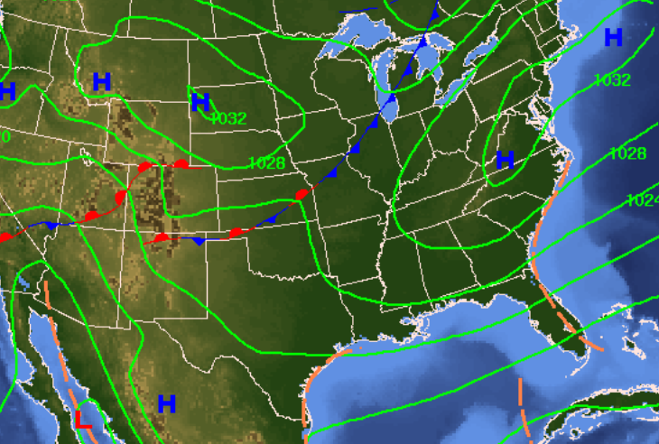
The cold front forecast to move into the area this weekend did indeed, but as a very slowly moving semi-stalled front, what’s being called a surface trough. As this feature made its way into the gulf it completely sheared apart the semi-tropical low that was spinning away in the gulf yesterday. We’re going to see a big change in the weather pattern from the tightening pressure gradient. Wind coming from the middle and east side of the state at similar latitudes will keep high temperatures. Starting tomorrow morning, the big change will come as moderate to strong east wind and lower humidity. The gradient loosens by Friday morning, and we’ll be back in a pattern of slack winds with afternoon sea breezes by next weekend.