The cold front is almost here. At the beach we’re experiencing prefrontal southwest winds accompanied by west southwest swell. Technically speaking, the frontal boundary isn’t quite here, but if we’re talking surfing terms, we would say the front is here because the surf associated with the front has come up. It’s pretty small at the moment, but should be on the rise. The winds will also be increasing as the afternoon progresses.
The swell is kind of like a long period swell. And by that I mean the swell is generated by a lot of fetch (winds stretching from Louisiana) and there theoretically should be a longer period between the best set waves. It doesn’t take much to bring the surf up when the swell is from the west. After the front arrives the swell period will shorten and the swell direction will switch more from the northwest. The nearshore buoy is currently reading like this:

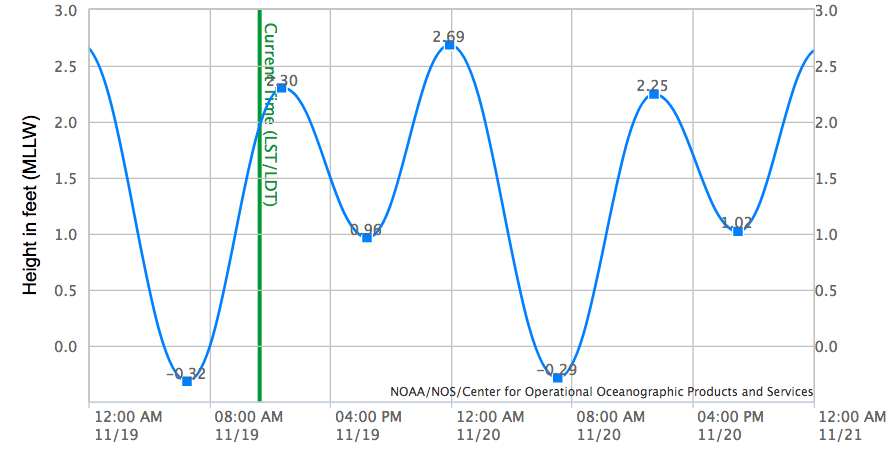
The tides today at Honeymoon Island peak around noon. Then around 6pm it’ll be the afternoon low tide. Tide graph below: