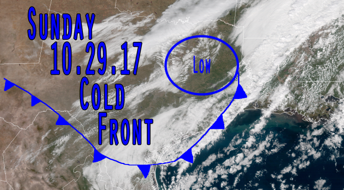
The cold front is now just a day and a half away from bringing the surf back up. This cold front looks really similar to last swell, almost identical in terms of wind strength and temperatuares, but the wind direction will be more from the northwest so the size and shape could be better. The actual low pressure center will be a little bit higher up as it slingshots the frontal boundary through the gulf. That will allow for a more northwesterly wind direction. Sunday the winds increase from the northwest. Sunday night the winds continue to blow from the northwest. Monday morning sometime before sunrise the winds go offshore.
We are making our way into late Fall and early Winter. Gradual averaging drops are happening to the important weather metrics like dew point, air temperature, and water temperature coinciding with the way the earth is orbiting the sun. That will cause the average temperatures to fall ever so slightly as we move through Fall and Winter up until about February.


