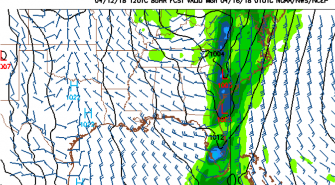
The second big cold front of spring is just about 3 days away. As the big cold front makes its way across the gulf on Sunday morning the south winds are expected to increase. By evening, right before the front comes through, the winds turn west southwest, and could be super gusty. This model is showing sustained winds at 25 knots right along the boundary. That means even stronger gusts. The next morning, Monday morning, the winds gust onshore from the northwest, dropping through the day. There doesn’t appear to be much of a cleanup, but maybe a small glassy wave on Tuesday.
The weather temps noticeably drop behind this front. This could be a 10 degree or more drop in air temperatures. Sunday afternoon evening should still be pretty warm. Monday during the day the high drops to around 72°, with upper 50s first thing that morning. The water’s up to 73° at Pier 60, but will be dropping overnight on Sunday night. The rain coverage will be super high as the front rolls through the area.
Update: Tuesday morning will have a really fun cleanup. North winds with 3-5 foot seas. It’s gonna be fullsuit weather with temps in the mid 50s.
The biggest surf will be Sunday right before sunset, then Monday morning. My guess is that this one will be the last big cold front of the 2017-2018 surf season.
Sunday/Monday tides:
![]()


